Marine research
The ocean is the source to resources such as food, energy, transport routes and recreation. Gathering knowledge and taking care of our oceans are vital for our existence.
Explore products Talk to an ROV expertGather knowledge about the ocean with underwater drones
Environmental monitoring may be carried out in many different ways, based on the goal for the research project. It may be mapping of marine litter, monitoring of coral reefs or inspections of a particular area to cover potential changes over a period of time.
The benefits of Blueye drones

Map marine habitats
Monitor changes to specific marine habitats by collecting video, images, and water spot samples.

No need for ROV pilots
Equip your team with tools to perform the inspections themselves. Expand their capabilities and utilize their expertise and knowledge.

Quick deployment
Deploy within minutes and perform your inspections efficiently to optimize your resources.
Webinar - USE OF UNDERWATER DRONES FOR EDUCATION AND RESEARCH
Listen to Prof. Martin Ludvigsen from NTNU tell more about the use of the Blueye underwater drones within the Science and Research field.
We saw quite clearly that the wrecks are about to be eaten up by species that have not been so far North earlier. This is also part of climate change.
Anne Husebekk
Principal, University of Tromsø

Read more: Utilizing underwater drones for mapping of marine archaeology

Blueye Cloud
Every transect on the map, with its video and sensor data
Blueye Cloud keeps everything from a survey dive together: the track on the map, the depth profile, the video and photos, and oxygen and salinity readings when the drone carries an environmental sensor. Come back to the same transect next season, and the earlier dives are a search away.
- Scrub along a transect and read depth, temperature and oxygen at each point
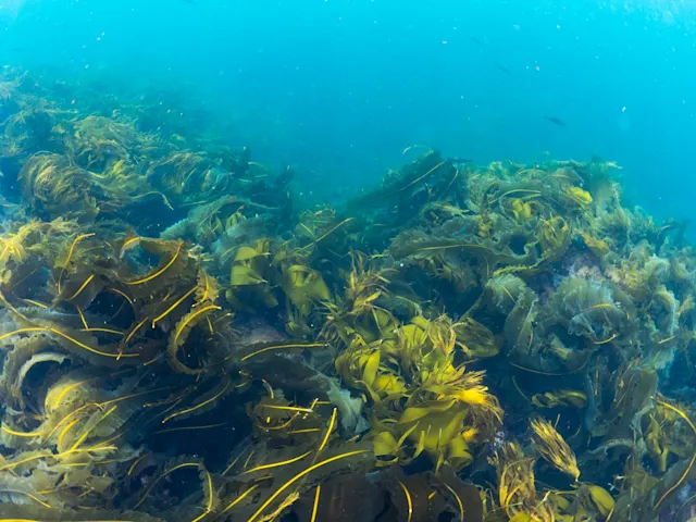
- See on the map where each photo of coral, kelp or seagrass was taken
- Search narrated dives for a species name and jump to the second it was said
- Share footage with students, partners or the public through a link, no account needed
Blueye Cloud is hosted in Europe
Dive analytics. Depth profile, GPS track and sensor readings for every dive, tagged and searchable.
Map replay. Replay the whole dive on the map, with video and photos synchronised to the track.

 12:48


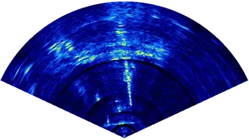 Multibeam

Media library. Photos, video and sonar recordings, ready to stream and open from any device.
Sonar mosaic
Turn sonar sweeps into a map of the seabed
Stitch the multibeam recordings in a project into one top-down acoustic map. Every ping is placed from the drone’s position and heading in the dive log, overlapping fans are aligned automatically, and the finished mosaic sits georeferenced on the map — for your team and everyone you share the project with.
- Built from the .mbez recordings and dive logs you already upload
- Overlapping fans aligned by image matching, with the transits between survey stations left out
- Adjust palette, contrast, and resolution live — processing runs on your own GPU, right in the browser
- Shown on the project map, on dives opened from the project, and on share links
- Download a georeferenced image, or export it as a custom map layer for the project or organisation
Blueye Explains / Episode 19
Aqua TROLL environmental sensor
Summer intern Sander explains the Aqua TROLL 500
See all episodes
Custom Package
The Blueye X3 Ultra ROV package
As inspections or underwater operations demand different setups, we encourage you to get in touch with us to help you with a customized package that suits your needs.
Based on feedback from our users we recommend professional customers to include their Blueye X3 Ultra order with an aluminum Zarges case, reel with 150 meter tether, Blueye High Capacity battery and Rugged controller. However, you are free to equip you ROV as you see fit for your usecase. We offer equipment from a wide range of suppliers, and other necessary ROV parts such as tethers come in different lengths.
Request a quote
Loading form …
From the field
Stories and experience

Article · Friday, October 31, 2025
Using ROVs in marine research to restore the Oslofjord
Discover how the non-profit Marea uses the Blueye X3 underwater drone for marine research and restoration of the Oslofjord, combining science, outreach, and technology.

Article · Friday, June 27, 2025
Cutting the cord - NTNU is removing the tether making the Blueye ROV an AUV
Cutting the cord - NTNU is removing the tether making the Blueye ROV an AUV. A PhD project about making the Blueye ROV autonomous.

Article · Thursday, August 8, 2024
Scientists from NTNU and UNIS are using Blueye ROVs to collect data from sub-surface ice structures at Svalbard
Scientists from NTNU and UNIS are using Blueye ROVs to collect data from sub-surface ice structures at Svalbard

Article · Monday, September 16, 2024
Runde Research explores cold-water corals in Sunnmøre with the Blueye ROV
Runde Research explores cold-water corals in Sunnmøre with the Blueye ROV

Article · Monday, February 26, 2024
How Faculty of Maritime Studies in Rijeka simplifies underwater study for all
In this article, we dive deep into understanding how Blueye ROVs contribute to the research and studies at the university and how seamlessly they integrated ROV into their activities.

Article · Friday, October 14, 2022
How the University in Tromsø is documenting intertidal species using ROVs
At the Arctic and Marine Biology department of UiT, Emily Venebles, an Engineer with a passion for the underwater world, and her students use Blueye ROVs for their fieldwork to observe the local ecology.
Talk to an ROV expert
If you have any questions, please do not hesitate to reach out directly!

James Nixon
VP International Solutions
Ask for a local representative
We have world wide presence through our Blueye Partners. Get in touch and we'll connect you.
Start a conversation
Loading form …