

What is a Critical Undersea Infrastructure (CUI)?
Critical undersea infrastructure refers to any underwater systems essential to communication, energy, transport, or security. Examples of CUIs include subsea internet cables, oil and gas pipelines, offshore wind farms, and power cables.
Globally, there are 570 in-service submarine cable systems spanning more than 1.5 million kilometers - that's equivalent to circling the Earth 37 times. In Norway, subsea cables stretch along the entire coastline.
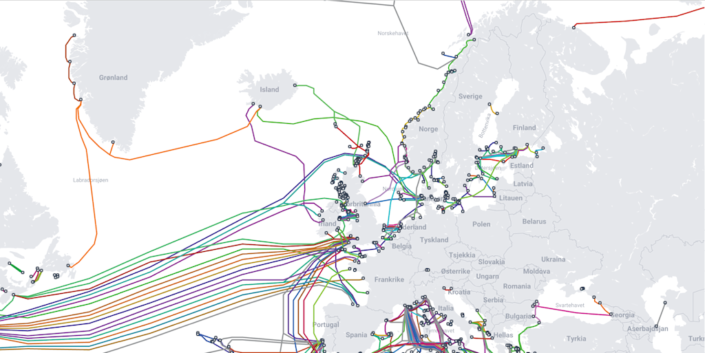
Subsea cables and underwater pipelines are vital to our daily lives, ensuring energy delivery and global communication. Some cables are semi-buried, while others lie exposed on the seabed. Rough weather, fishing trawlers, anchoring vessels, and human activity are constant threats to their integrity. A key event that brought this issue into the spotlight was the sabotage of the Nord Stream pipeline in September 2022.
How are these infrastructures traditionally surveyed, and how can we monitor them even smarter?
Traditional survey methods include deploying divers and operating large work-class Remotely Operated Vehicles (ROVs). These surveys have often been infrequent and reactive - typically carried out only when a known issue occurs, rather than as part of a proactive strategy to prevent failures.
Modern technology - including AUVs (Autonomous Underwater Vehicles), USVs (Uncrewed Surface Vessels), portable ROVs, aerial drones, aircraft, and satellites - now provides infrastructure owners and authorities with powerful new tools for monitoring. AUVs can travel long distances and survey large areas, while advanced ROVs can be quickly deployed and deliver live video to assess the condition of underwater assets. When these systems are integrated with surface vessels, aerial platforms, and satellite data, they form a comprehensive sensor network capable of monitoring CUIs more effectively.
Combining the capabilities of USVs, satellites, aerial support and ROVs
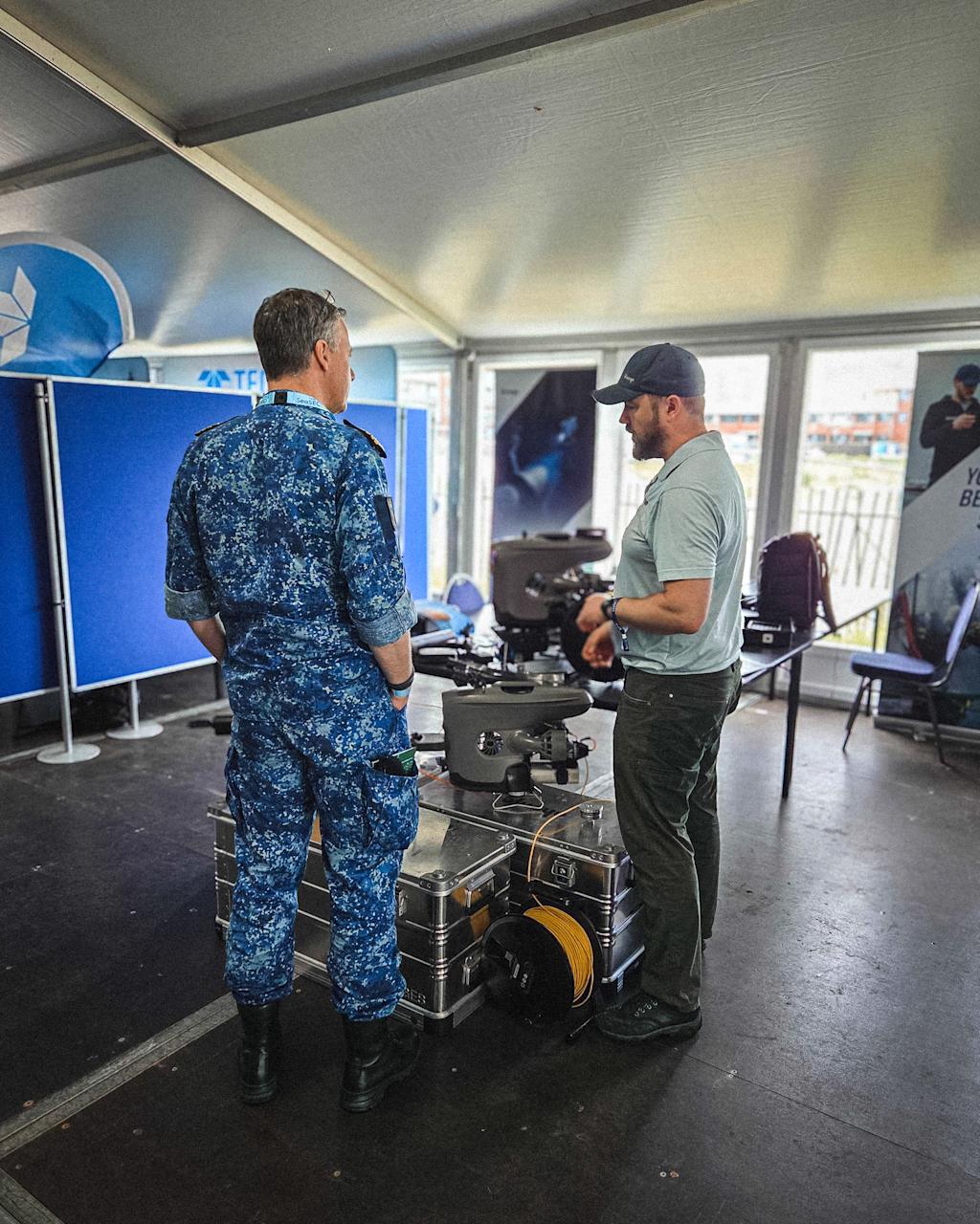
To meet the emerging threats to critical undersea infrastructure, the Seabed Security Experimentation Centre (SeaSEC) was launched as an initiative of the Northern Naval Capabilities Cooperation (NNCC), led by the navies of the Netherlands, Norway, Sweden, Finland, Denmark, and Germany. Blueye Robotics was invited to join the SeaSEC Challenge Weeks in May 2025, where we, together with other industry partners, participated in real-world maritime tests to showcase our capabilities.
The SeaSEC Challenge Weeks were structured around three operational seabed security challenges:
- Detecting and tracking underwater vehicles
- Locating and classifying threats near pipelines
- Identifying anomalies on the seabed
In collaboration with industry partners, SeaSEC demonstrated the combined capabilities of AUVs, USVs, ROVs, sensor pods, and seabed crawlers - all working toward a shared mission.
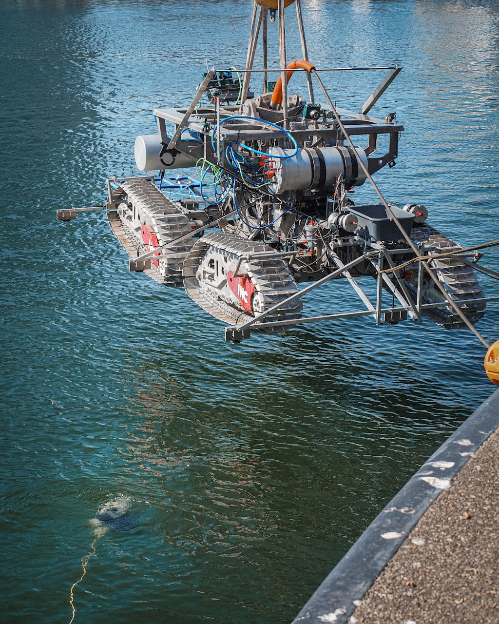
These technologies are already commercially available, and innovation is progressing rapidly. One particularly effective approach is a USV–ROV combination. A USV can autonomously patrol and scan wide areas for anomalies. However, it lacks the ability to live-stream video from beneath the surface. This is where the ROV steps in: once an anomaly is detected, a Blueye ROV can be deployed to quickly locate and stream live video of the object of interest.
Maritime Robotics, a Norwegian company based in Trondheim, has conducted tests using satellites and a specially designed USV equipped with a Blueye ROV. See the video below for further explanation.
Conclusion
Surveying and monitoring CUIs is undoubtedly a complex task - but it’s also an essential one. The technology to do it exists today, and both private and public sectors must work together to protect these vital systems. Initiatives like the SeaSEC Challenge Weeks are a great step in the right direction.
Want to learn more about how Blueye can help secure and document the structural integrity of critical underwater infrastructure? Feel free to get in touch!


