Blueye Drone Payload
Underwater GPS G2 R100 Blueye Kit
Know where your ROV is located, and save it's position track onto a map. With Water Linked's purpose-developed positioning technology, unwanted noise no longer affects positioning accuracy the way it traditionally has with underwater positioning solutions. Get all images and videos geotagged automatically to ease reporting.
Water Linked

A complete positioning system
The positioning system is set up in minutes and provides high-accuracy position tracking of the ROV during your inspections. A benefit of using an external positioning system is that it does not drift over time, which allows you to maintain good position tracking during your longer inspections.
The system can be used on all our vehicles, meaning that you can get position data even into our very first model, the Blueye Pioneer by simply updating the Blunux software.
The UPGS G2 R100 Blueye kit consists of:
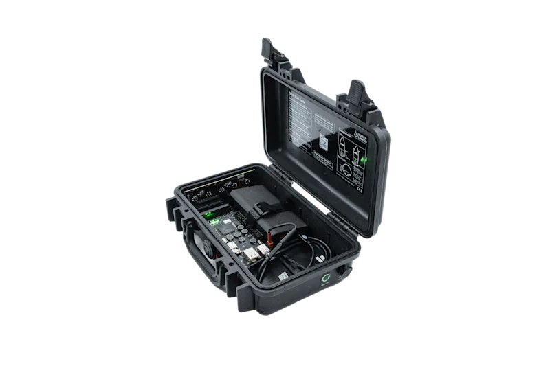
UGPS G2 Topside 100m range (inkl. Powerbank and USB-C charging cable)
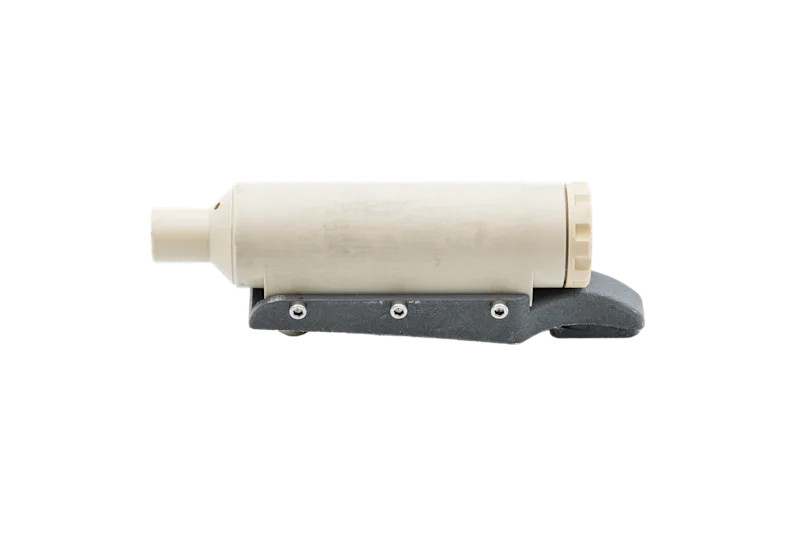
Locator U1 (inkl. Blueye mounting bracket)
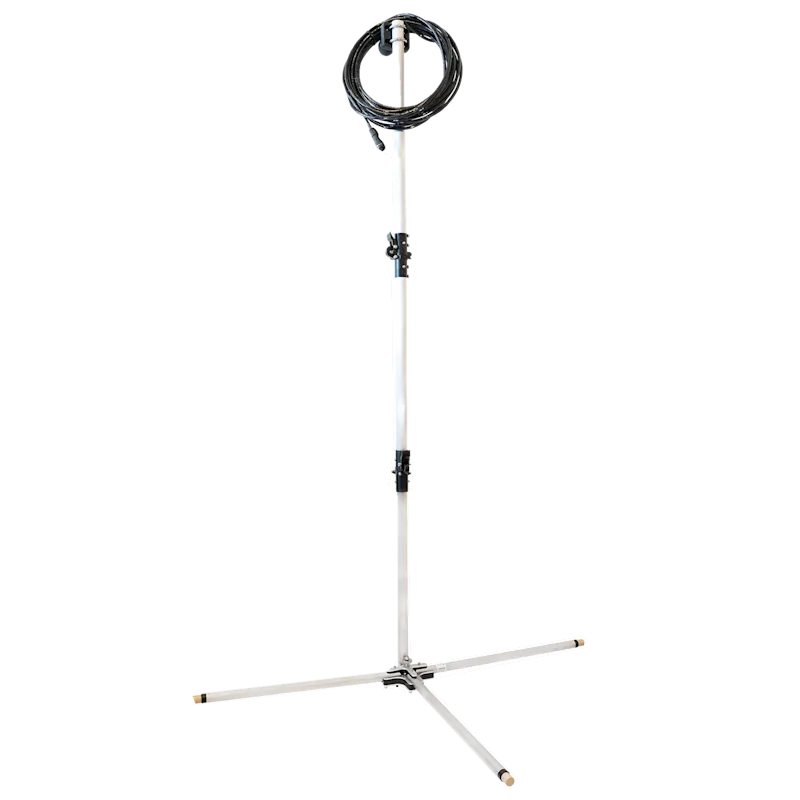
Antenna (inkl. 3x RAM mounts)
How does it work?
The G2 Topside is connected to the G2 Antenna which must be mounted near/in the water with direct line of sight to the Locator. The battery powered Locator U1 is mounted on to the Blueye ROV (No cable integration needed, therefor compatible with all Blueye ROV models). A Wi-Fi signal emitted by the internal Web server of the G2 Topside allows the user to track the Locator/ROV using the Water Linked Web-based GUI.


Technical Specifications
Underwater GPS G2 R100 Blueye Kit
The UGPS system is measuring the time it takes for a ping to travel from the U1 locator to the 4 transducers in the antenna. When the speed of sound in water is known we then get four sightly different distances. With classic triangulation the system can then provide a position estimate in X and Y, and the depth is measured with a pressure sensor.
Download

Mechanical | |
Kit weight | 4-6 kg |
Housing external dimensions | 30 x 21 x 10 cm (Pelican case) |
Depth rating | 300 m |
Operating temperature | -10 to 60 °C |
Acoustic Performance | |
Range | 100 or 300 meter radius (depending on version selected) |
Ping rate | 2-4 hz |
Accuracy | Horizontal range : <0.2 % |
Long term drift | Locator U1: ~1 meter per 6 hours in static heading config |
Frequency | 31.25-250 kHz (200 kHz typical) |
Directivity | Omnidirectional, 360 ° |
Operating principle | Time of flight, Triangulation |
Integrated IMUs | Yes |
Integrated GPS | Yes |
Approvals | |
CE | Yes |
Related products: Navigation and positioning


-
![Waterlinked uGPS mounted on Blueye Pro]()
Waterlinked uGPS mounted on Blueye Pro
-
![Waterlinked uGPS mounted on Pro closeup]()
Waterlinked uGPS mounted on Pro closeup
-
![UGPS-R100-vs-R300]()
UGPS-R100-vs-R300
-
![UGPS G2 Pelicase Side]()
UGPS G2 Pelicase Side


